


les 3 bec par la picourere

guyzinz
User

Length
9.2 km

Max alt
1546 m

Uphill gradient
744 m
Km-Effort
19.1 km

Min alt
909 m

Downhill gradient
735 m
Boucle
Yes
Creation date :
2019-06-07 09:38:57.048
Updated on :
2019-06-07 09:38:57.254
3h46
Difficulty : Difficult

FREE GPS app for hiking
 SityTrail
IGN / Geographical institutes
SityTrail Plus
The world is yours!
About
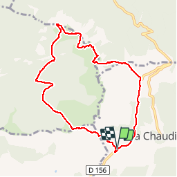
Trail Walking of 9.2 km to be discovered at Auvergne-Rhône-Alpes, Drôme, La Chaudière. This trail is proposed by guyzinz.
Description
depart col de la chaudiere le pas de la picourère roche courbe la laveuse pre de l'ane pas de la siarra
Positioning
Country:
France
Region :
Auvergne-Rhône-Alpes
Department/Province :
Drôme
Municipality :
La Chaudière
Location:
Unknown
Start:(Dec)
Start:(UTM)
674901 ; 4944179 (31T) N.
Comments